Yosemite Extreme Panoramic Imaging Project
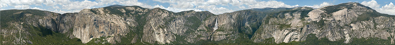
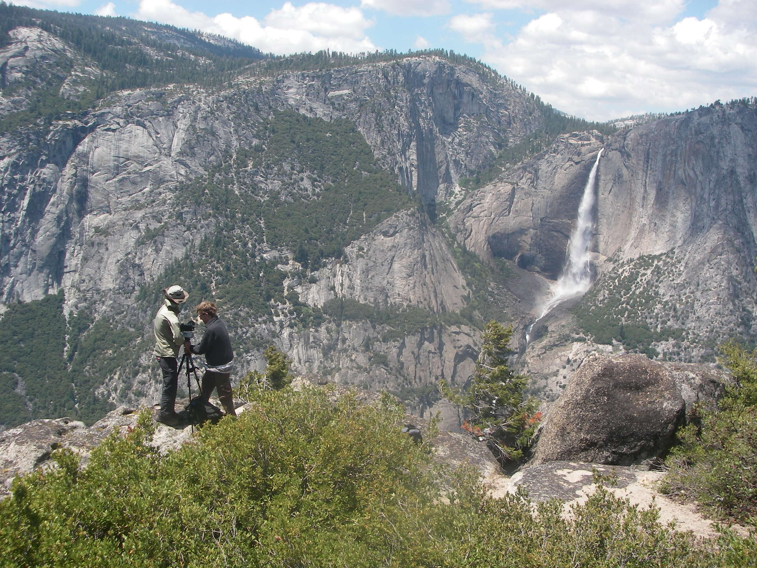
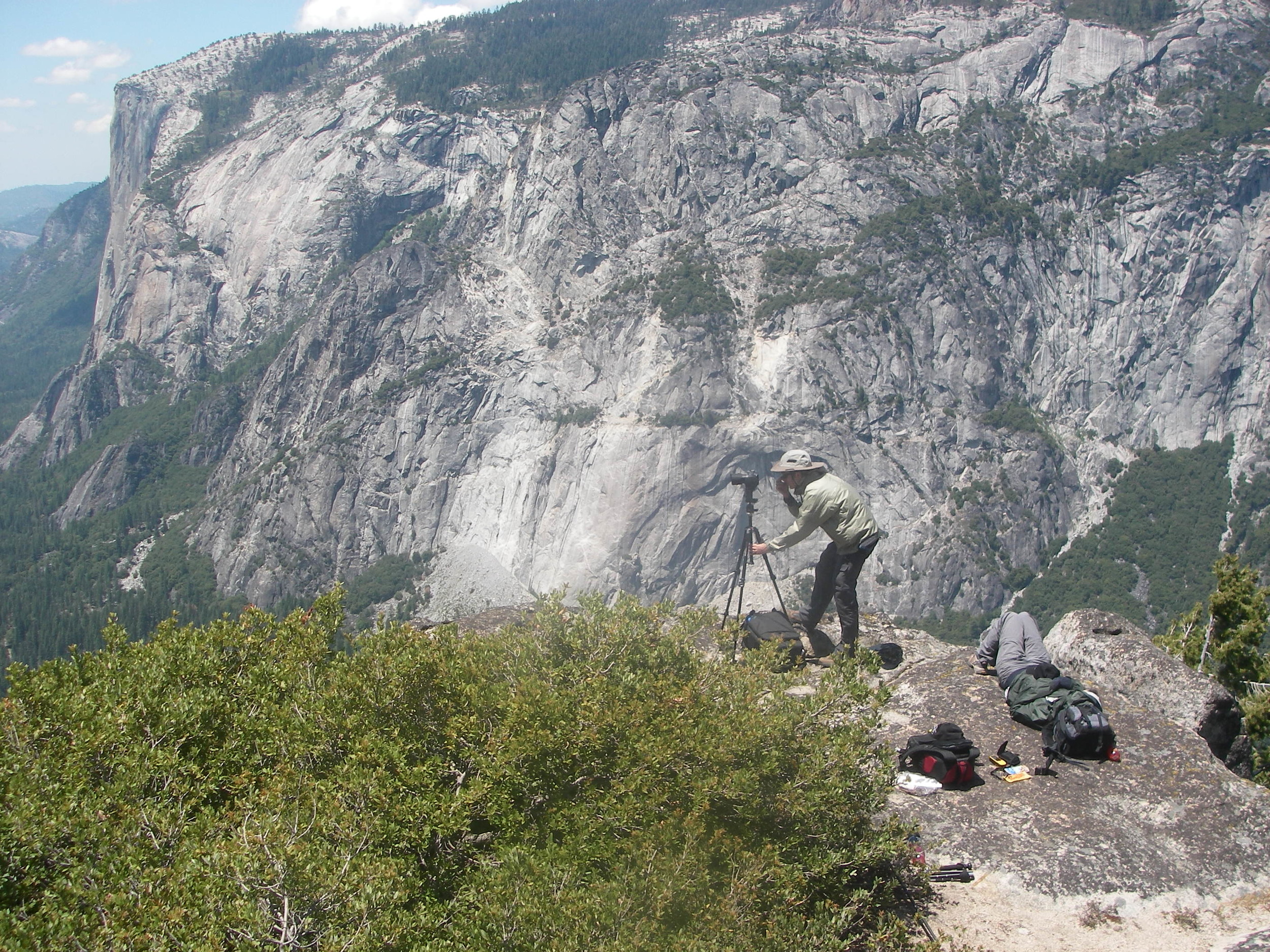
In the early summer of 2008 I was honored to be part of an immense undertaking by Greg Downing and Eric Hanson of xRez Studios. Their mission was to create a single unwrapped lateral view of the entirety of Yosemite Valley. The reason for a lateral view? So the park's geologist Greg Stock could study the valley rockface and analyze and determine areas of instability where potential rockfall was could occur. This is a huge problem the park faces in trying to keep the thousands of vistors safe each day. In fact there has already been large rockfall events since our project there.
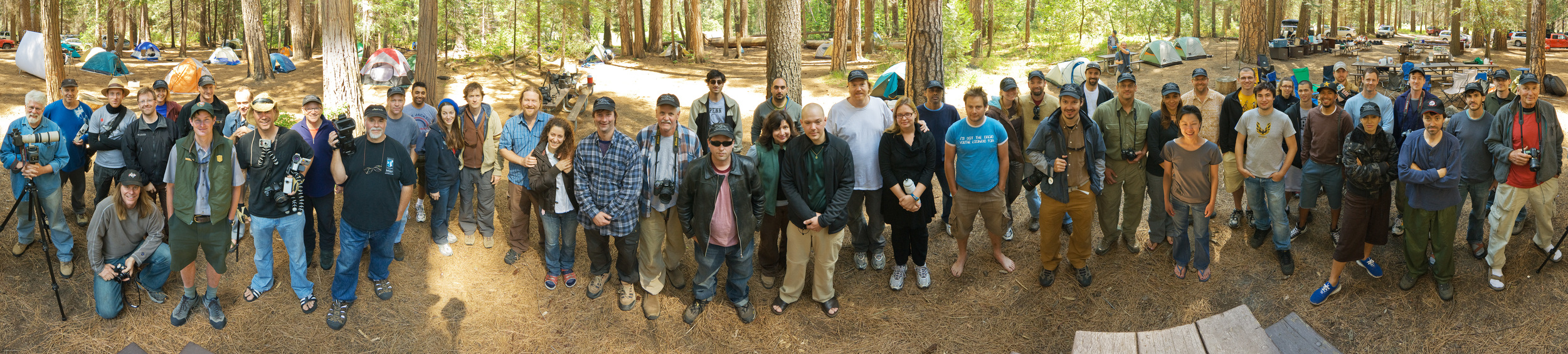
With many big name sponsors (Google, Microsoft) and nearly fifty-five Panoramic photographers, twenty teams where trained with what in 2008 was the first commercial grade gigapan gigapixel prototype panoheads. Gigapan Systems as a company was just starting out and they graciously loaned 18 beta units for the cause.
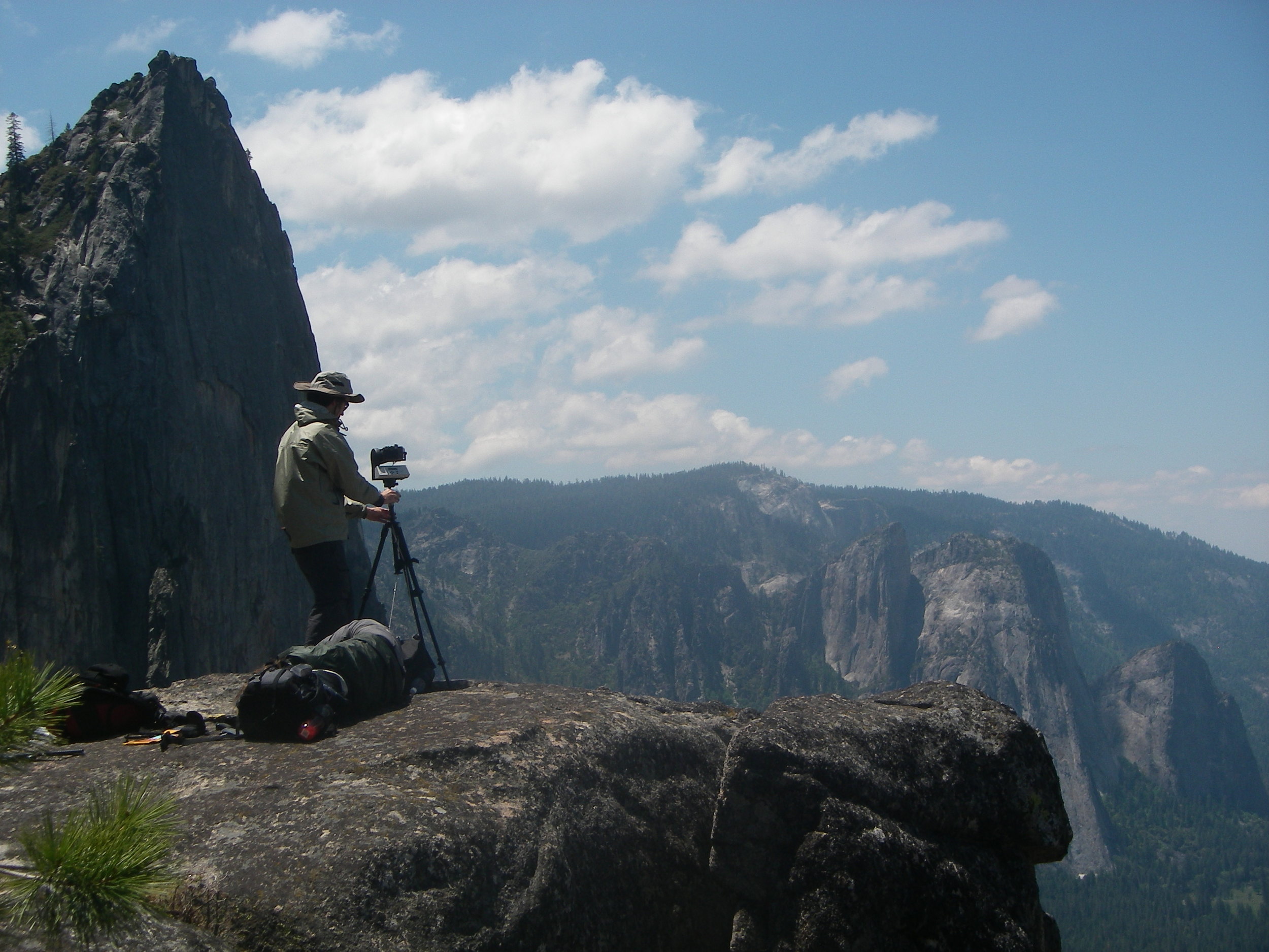
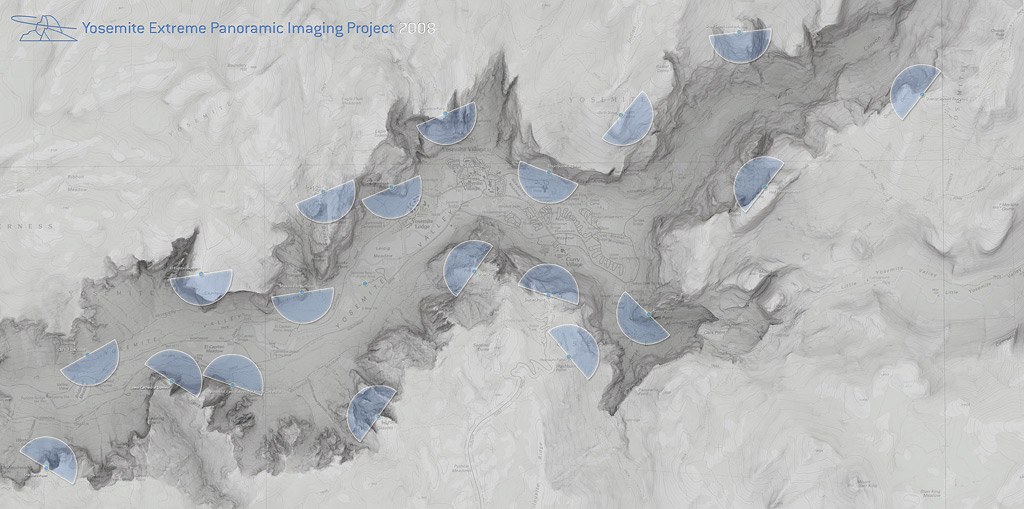
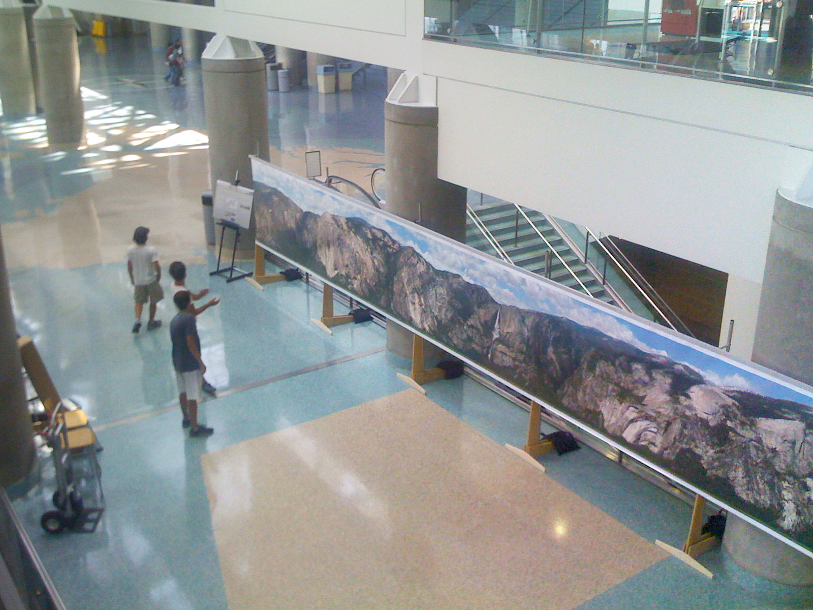
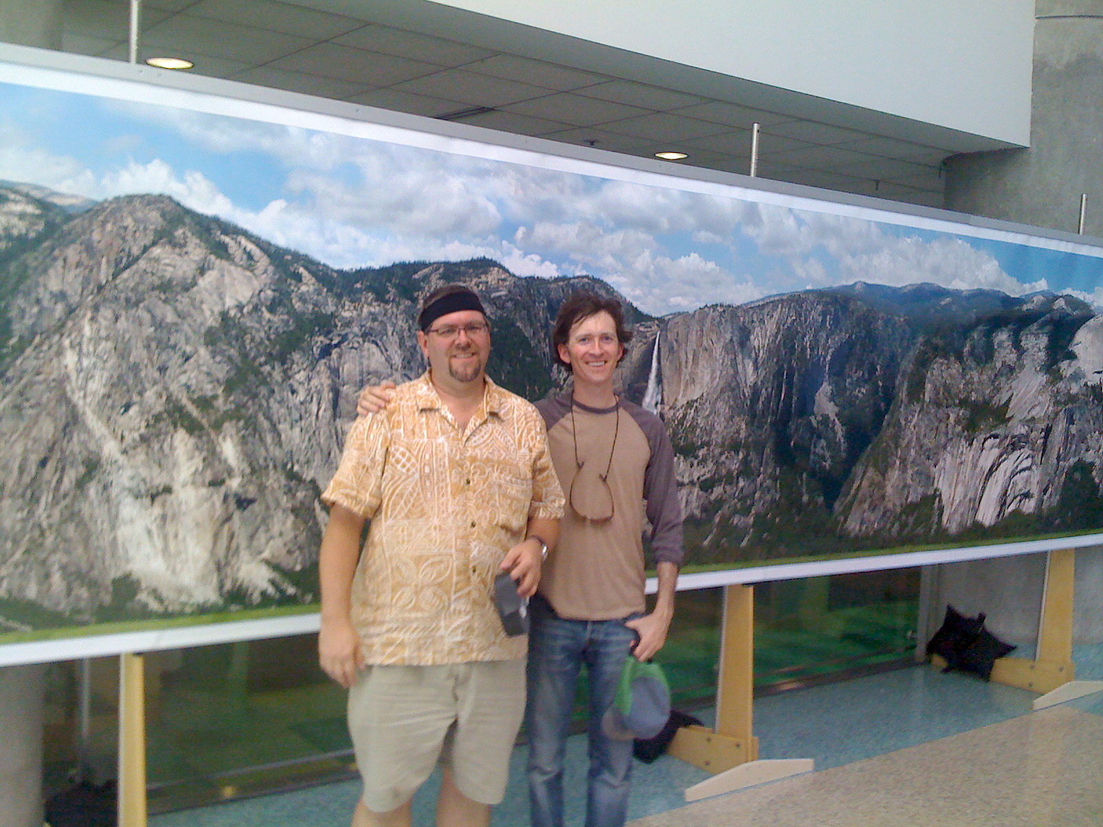
Each team was required to hike to an exact predetermined shooting location. When all the teams where in place they marked their GPS coordinates and with walkie-talkies each team signaled in succession from 20-1. Then we hit "go" on the units and the entirety of Yosemite Valley was simultaneously shot in extreme resolution from a human vantage for the first time. Once xRez collected all of the data, the 20 gigapixel panos, they projected the images onto an unwrapped computer model of Yosemite valley. The model had been generated by a low pass DEM Digital Elevation Map. Since the scan and the panos contained so much detail they meshed together nicely. xRez used the GPS cordinates so they would know the exact alignment projection point.
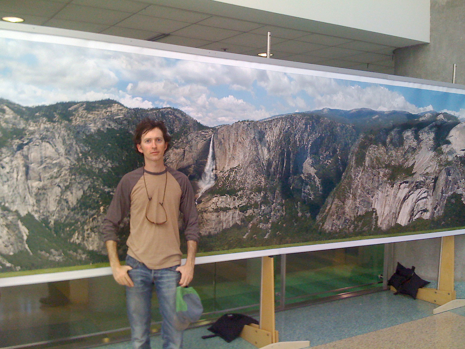
You can click on the third and fourth image below to see the results. The final panorama has also been printed and exhibited at various events and displayed on interactive walls/screens/tables.